Remote Sensing & Gegraphic Information Systems (GIS)
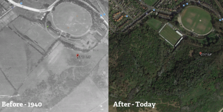
Remote Sensing and Geographic Information Systems (GIS) and remote sensing technologies have become indispensable tools in conservation. They allow for the collection, visualisation, and analysis of environmental data at an unprecedented scale. High-resolution satellite images can monitor deforestation, track wildlife populations, and assess the health of ecosystems from space. This bird’s-eye view is crucial for creating effective conservation strategies and responding quickly to environmental threats.


